


ROYAL PALM Voting District, Maricopa County, Arizona
About
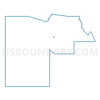
Outline

Summary
| Unique Area Identifier | 524770 |
| Name | ROYAL PALM Voting District |
| County | Maricopa County |
| State | Arizona |
| Area (square miles) | 0.49 |
| Land Area (square miles) | 0.49 |
| Water Area (square miles) | 0.00 |
| % of Land Area | 100.00 |
| % of Water Area | 0.00 |
| Latitude of the Internal Point | 33.56030880 |
| Longtitude of the Internal Point | -112.09545070 |
Maps


Graphs
Select a template below for downloading or customizing gragh for ROYAL PALM Voting District, Maricopa County, Arizona


Neighbors
Neighoring Voting District (by Name) Neighboring Voting District on the Map
- CINNABAR Voting District, Maricopa County, AZ
- EL CARO Voting District, Maricopa County, AZ
- GLENN Voting District, Maricopa County, AZ
- ORANGEWOOD Voting District, Maricopa County, AZ
- SILVERTREE Voting District, Maricopa County, AZ
- SPRUCE Voting District, Maricopa County, AZ
- TOWNLEY Voting District, Maricopa County, AZ
Top 10 Neighboring County Subdivision (by Population) Neighboring County Subdivision on the Map
Top 10 Neighboring Place (by Population) Neighboring Place on the Map
Top 10 Neighboring Elementary School District (by Population) Neighboring Elementary School District on the Map
Top 10 Neighboring Secondary School District (by Population) Neighboring Secondary School District on the Map
Top 10 Neighboring State Legislative District Lower Chamber (by Population) Neighboring State Legislative District Lower Chamber on the Map
- State House District 10, AZ (163,683)
- State House District 11, AZ (161,630)
- State House District 15, AZ (155,897)
Top 10 Neighboring State Legislative District Upper Chamber (by Population) Neighboring State Legislative District Upper Chamber on the Map
- State Senate District 10, AZ (163,683)
- State Senate District 11, AZ (161,630)
- State Senate District 15, AZ (155,897)
Top 10 Neighboring 111th Congressional District (by Population) Neighboring 111th Congressional District on the Map
Top 10 Neighboring Census Tract (by Population) Neighboring Census Tract on the Map
- Census Tract 1061, Maricopa County, AZ (5,282)
- Census Tract 1045.01, Maricopa County, AZ (3,697)
- Census Tract 1054, Maricopa County, AZ (3,603)
- Census Tract 1055.03, Maricopa County, AZ (3,279)
- Census Tract 1044.02, Maricopa County, AZ (2,538)
- Census Tract 1060.02, Maricopa County, AZ (2,248)
- Census Tract 1055.02, Maricopa County, AZ (1,891)